
Model the crisis before it happens — plan, train, be ready

A scenario modeling platform for wildfire and flood emergency planning. Real terrain from Google Maps Elevation API, dynamic physical simulation, LLM-generated scenario variations. Run the "what if" scenarios your team hasn't trained for — before a real emergency makes them run them for the first time.


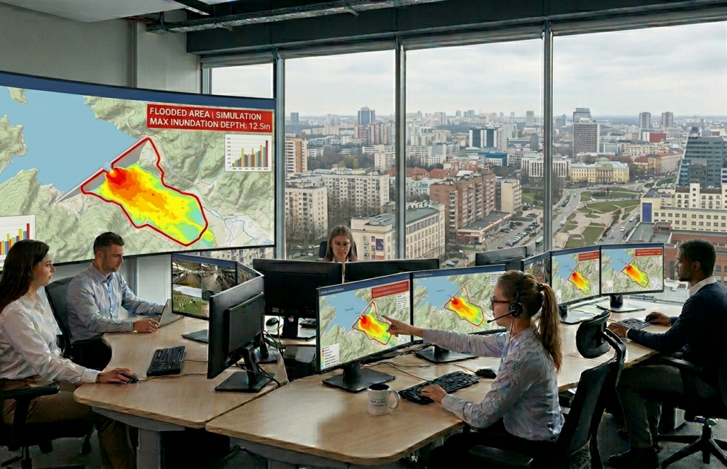
This concept can be used for building full scale platform for planning stage to stress-test evacuation routes, resource allocation and inter-agency coordination. In addition this platfrom can be used for training stage to put incident commanders, dispatchers and facility operators through those same scenarios repeatedly, building the decision reflexes that only come from experience. The same platform. Two modes of use. One outcome: the gap between your plan and reality gets smaller before it matters.
The problem

A plan is only as good as
the scenarios it was tested against

Emergency plans are written in offices, often based on historical averages and best-case assumptions. When a wildfire wind shifts or a dam breach sends water in an unexpected direction, the gap between the plan and reality becomes immediately visible — and costly. The question is not whether that gap exists, but whether you have found it before the emergency does.

A wildfire incident commander who has never experienced a wind shift in simulation will respond to one in reality as a new cognitive problem — burning seconds analysing a situation they should recognise and act on in under 90 seconds. A flood emergency manager who has never seen water follow real terrain on a time-compressed model cannot pre-position evacuation resources correctly.

The real cost of unpreparedness

Over 70% of firefighter entrapments occur following unexpected wind shifts. In flood management, delayed evacuation decisions — typically caused by uncertainty about water spread — account for the majority of preventable casualties. Both are scenarios that can be trained, but only if the training replicates the dynamic conditions of reality.

The goal is not to write a better plan. It is to stress-test the plan you have against scenarios you haven't imagined yet.


Application domains

Two environments,
one planning platform

Both wildfire and flood scenarios share a common architecture: real terrain from Google Maps Elevation API, dynamic physical simulation and LLM-generated scenario variation. Planners and trainers build scenarios in plain text — no GIS expertise or coding required.
01
🔥 Wildfire Management
critical
Wind direction shift
Wind rotates 90° at minute 8, surges to 11 m/s. Commander has 90 seconds to recall crews from threatened sectors and redeploy equipment to protect the settlement.
Crew cut off from exit
Flank fire blocks retreat route. Decide on backfire or helicopter extraction — under hard time pressure with no second chance.
Equipment redeployment
Three sectors burning, insufficient equipment for all. Prioritise settlement, forest or retreat road — and bear responsibility for that choice in the after-action review.
Settlement evacuation
Fire advancing on a village. Forecast spread by terrain and wind. Decide evacuation column order and defensive perimeter placement.
02
🌊 Floods &Inundations
critical
Dam breach on real terrain
Breach point placed on Google Maps elevation. Wave spreads across actual heights — specialist sees which streets flood first and makes evacuation decisions accordingly.
Rising flood on catchment
Slow level rise with variable rainfall forecast. Core dilemma: premature evacuation vs delayed response — with incomplete information and a closing time window.
Industrial site flooding
Water approaching plant perimeter. Sequence protection actions: berms, equipment shutdown, personnel evacuation by priority — on the actual site layout.
Multi-agency coordination
Multiple specialists managing different services on a shared 3D real-map environment. Practise handoffs and responsibility boundaries under time pressure.
Core mechanic · Wildfire

Wind program —
time-sequenced change

The instructor defines wind behaviour as a time sequence in plain text. The engine translates this into a physics simulation that recalculates the fire front in real time — the trainee cannot prepare for a static scenario, they must respond to a moving one.
🔥
Rothermel fire spread model on real elevation
Industry-standard USFS model accounting for slope, fuel moisture and live wind vector

The instructor describes wind behaviour in natural language: initial speed and direction, change points with timing, gust flags. The LLM translates this into a structured wind programme. The engine runs the Rothermel model — the standard used by US Forest Service — at each timestep, accounting for terrain slope (from Google Maps elevation), fuel moisture and current wind vector.

As wind changes, the fire front recalculates. The trainee sees the projected spread, assesses which crews and assets are now at risk, and must issue commands within the decision window. Everything is recorded as timestamped xAPI events — time to first action, sequence correctness, resources left in danger zones.

After the session, an AI-generated after-action report identifies the specific decision point where the trainee gained or lost time, and what a correct response would have looked like.

Example wind programme
0 min: 4 m/s heading W. At min 8: gust to 12 m/s, rotate 110° — new front aims at the settlement. At min 15: stabilise at 8 m/s on new heading. Trainee has 90 seconds to respond at minute 8.
Terrain from Google Maps Elevation API
Uphill slope accelerates fire spread; downhill slows it — exactly as in reality. Trainees learn to read terrain as a risk factor that changes the effective spread speed in every direction.
Constrained resources — forced trade-offs
There is always less equipment than needed. Protecting one sector means accepting risk in another. The choice — and its consequences — appear in the after-action report.
Core mechanic · Hydrology

Real terrain —
real flood behaviour

Flood behaviour cannot be modelled convincingly without real topography. The platform loads actual elevation data for any location on Earth — the trainee practices on the terrain they will actually manage, not a generic model.
🌊
Google Maps Elevation API integration
30 seconds from coordinates to rendered terrain with satellite overlay

The instructor enters geographic coordinates or a location name. The system queries Google Maps Elevation API at 25–100 m resolution, builds a terrain mesh in Babylon.js and overlays a satellite texture. The whole process takes about 30 seconds — no GIS software, no data preparation.

The LLM overlays the hydrological scenario: initial water level, rise rate, breach point, surge timing. The engine simulates water movement following real elevation contours — the trainee sees exactly which streets, buildings and infrastructure flood first, and in which order.

Risk zones at 1h, 3h and 6h horizons update as the scenario progresses, forcing the trainee to plan ahead rather than react to already-flooded areas.

Any location, 30 seconds
Enter the coordinates of the river system, dam or catchment area. Terrain renders automatically — the trainee is immediately working on their actual operational territory.
Time-horizon risk zoning
System marks projected flood extents at 1h, 3h and 6h. Trainees learn to read the time dimension — pre-positioning resources before areas flood rather than reacting after.
Industrial facility on its real layout
Upload the site plan. Water approaches the perimeter on the actual plant layout — protection sequences are practised exactly as they would be executed in reality.

How it works

From scenario description
to live simulation

A training officer describes the scenario in plain language. The system builds the simulation, loads real terrain, and starts the dynamic environment — in under 30 minutes, with no technical skills required from the instructor.
01
Scenario author
Description in the web editor
A training engineer describes the emergency: location, trigger conditions, available resources, correct action sequence and evaluation criteria. No code — just text and parameter selection. For wildfire scenarios: terrain location, initial fire position and wind programme. For floods: river system, breach point and rise rate.
Web Editor · React · No code
02
LLM pipeline
Scene generation via Claude API
The prompt builder sends the description to Claude API with a strict Scene JSON schema. The model generates objects, event sequences, wind programmes or hydrological parameters, decision triggers, AI tutor hints and xAPI event labels for every key action.
Claude API · JSON Schema · Validation loop
03
Engine
Babylon.js renders on real terrain in browser
No installation. Terrain loads from Google Maps Elevation API in ~30 seconds. Fire spread uses the Rothermel model accounting for slope, fuel moisture and current wind vector. Flood simulation follows real elevation contours. Both update dynamically as conditions change — forcing the trainee to respond to a moving situation, not a static exercise.
Babylon.js · Havok · Google Maps Elevation API · WebXR
04
Trainee
Commander runs the simulation
Every decision — crew recall, equipment deployment, evacuation order, resource request — is recorded as a structured xAPI event with a timestamp. The adaptive AI instructor responds contextually to errors based on full session history, not generic hints. Scenarios can be repeated with different wind programmes or breach points each time.
xAPI events · Claude API · ElevenLabs voice
05
Training manager
Readiness dashboard and certification
Full decision log per trainee: correct first-time choices, repeated attempts, systematic errors. LLM generates a readiness-for-deployment statement. Integrates with corporate LMS via LTI 1.3 — completion certificate pulls through automatically.
xAPI LRS · LTI 1.3 · AI assessment report

Organisational value

Documented readiness
before first deployment

The key outcome is not "commander completed the course" — it's "the organisation can demonstrate that its commanders have responded correctly to a wind shift and a dam breach scenario before being deployed to a real incident."
repetitions of wind shift and dam breach without real risk
100%
decisions documented — full readiness audit trail
30s
any location loaded from Google Maps elevation data
30′
from new scenario description to first trainee session

Why scenario modeling matters

A tabletop exercise with a static map tells you whether your team knows the procedure. A dynamic simulation on real terrain tells you whether your plan survives contact with a wind shift, an unexpected flood path or a resource shortage. The scenarios you haven't run are the scenarios that will surprise you. The platform makes it easy to run them — before they happen.

Positioning

The platform does not replace field exercises or certified emergency management programmes. It occupies the stage before — where plans are stress-tested against realistic scenario variations, gaps are identified, and staff build familiarity with dynamic conditions before a real event.

Want to Be Prepared to the Next Wildfire or Flood?

Let's talk about how we can help to be prepared to protect your county from flood or wildfire